
CCLHP: The County - Maps and History
Coles County
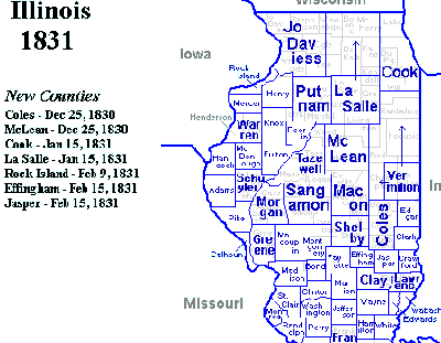
Created in 1830, Coles County included most of present-day Coles, Douglas, and Cumberland Counties.
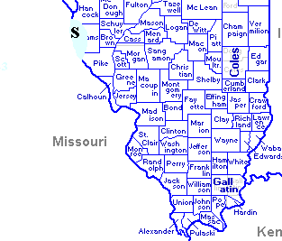
Illinois 1843
1843-59, Coles County included present-day Coles and Douglas counties.
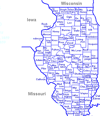
Illinois 1859
From 1859, Coles County and all Illinois counties laid out as present-day counties.
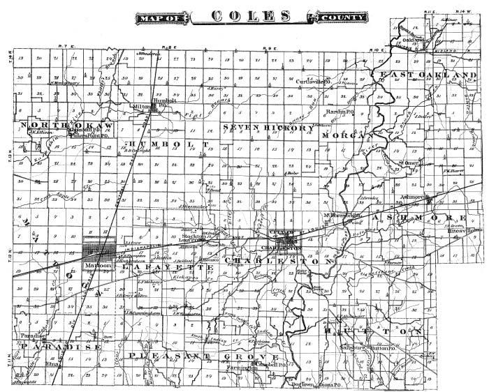
Coles County Townships (19th century): North Okaw, Humbolt, Seven Hickory, Morgan, East Oakland, Mattoon, Lafayette, Charleston, Ashmore, Paradise, Pleasant Grove, Hutton, Coles
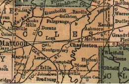
County towns and villages (19th century) [brackets = on border of county]: Fuller, Cooks Mills, Humboldt, Fairgrange, Bushton, Rardin, [Coles], Mattoon, Dorans, Loxa, Charleston, McPherson, Ashmore, Magnet, Montgomery, Lerna, Etna, Trilla, [Janesville], Campbell, Diona, Hutton

Population density remained low in the area outside the river bottom lands (including northern and western Coles County) until (a) the introduction of the self-scouring plow to break up the prairie, and (b) railroad construction.

Railroads in Coles County began in 1855. Mattoon was part of the north-south line, the Illinois Central Railroad. Later, an east-west line was constructed through Charleston.