POINTS FROM XY COORDINATES
The city of Chicago provides crime data in the form of *.csv tables with lat/lon coordinates. QGIS treats *.csv tables as a data source that can be included in a map without converting to a shapefile. In this tutorial, we'll be looking at crime data from Aug. 2014 to Aug. 2015:
- Click the Add Delimited Text Layer button:
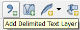
2. Click Browse
3. Navigate to the qgis_workshop_data folder and select Crimes.csv.
The dialog should autopopulate with the following options:
Note that a Point Geometry definition has automatically been selected using the Longitude and Latitude fields. This is correct, so click OK.
4.You should see the following warning:
![]()
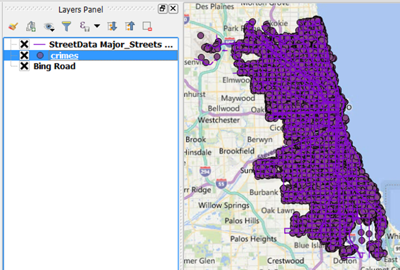
and the points will be added to the map:
5. The actual coordinate system is NAD 1983. The difference is very small, but let's go ahead and correct it
- Right-click on the crimes layer and select Properties.
- Select the General tab.
- Click the button next to the selected coordinate reference system (CRS):
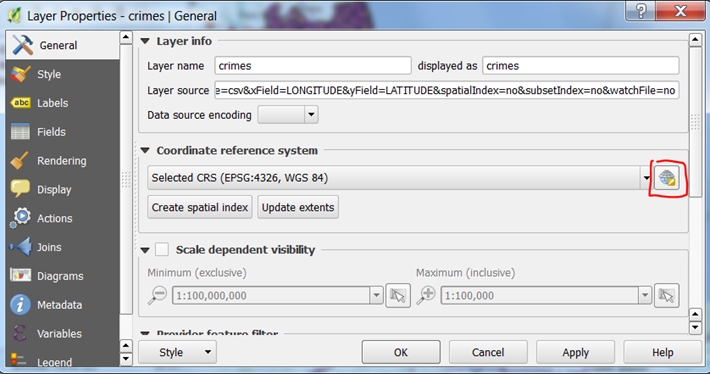
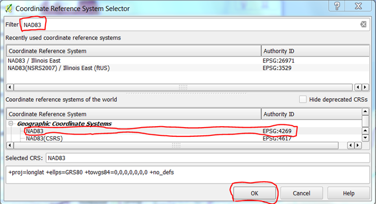
- In the filter type "NAD83", select NAD83 EPSG 4269 and click OK:
- Click OK again. The crime data is now registered to the correct CRS.
In the next section, we'll obtain police stations from OpenStreetMap.