


Mapping Coles County: Types of Maps
Maps vary widely in purpose, method, care of construction and accuracy. When using maps for local history, it is important to determine:
- The map's purpose
- The date the map was made
- The scale
- The accuracy and completeness of the map
- The mapmaker's bias
The following six types of maps can commonly be found and used by local historians in their research:
- Plat maps
- Political, economic and social maps
- County maps and atlases
- Bird's eye or panoramic maps
- Sanborn or fire insurance maps
- Interment maps
Plat Maps
Plat maps show land subdivision and record individual property ownership for taxation purposes and land sales promotion. New plats are produced every time land is subdivided or a community annexes a new addition.
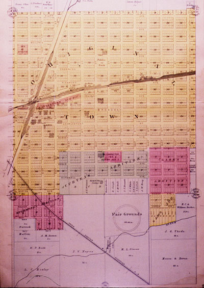
1893 Plat Map of the East Side of Mattoon, IL.
Political, Economic and Social Maps
Political, economic and social maps illustrate the networks and links that exist within communities and between communities. A wide variety of maps fall into this category. These maps can show transportation networks, political divisions within a state, land division patterns, settlement patterns, historical events, or ethnicity, among other things.
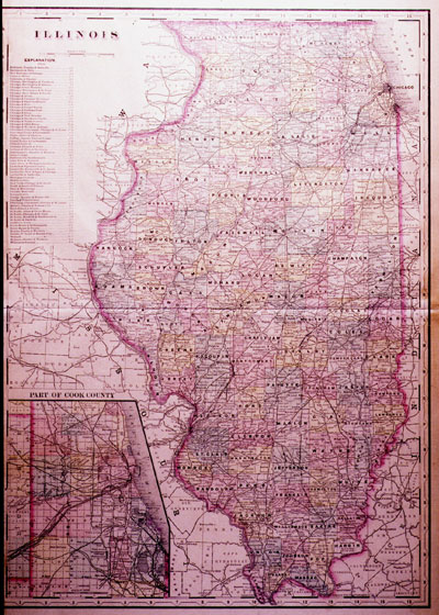
1893 Transportation Map of Illinois showing railroads.
County Maps and Atlases
Companies produced county maps and atlases during the nineteenth century much in the same way they produced county histories. Plat books and atlases usually contained a separate plat for each township, as well as larger towns and cities. Each map typically showed roads, railroads, property lines and names of property owners, schools, churches and cemeteries. The maps were printed using color lithography. For a fee, property owners could have a picture of their home or business used as a border illustration.
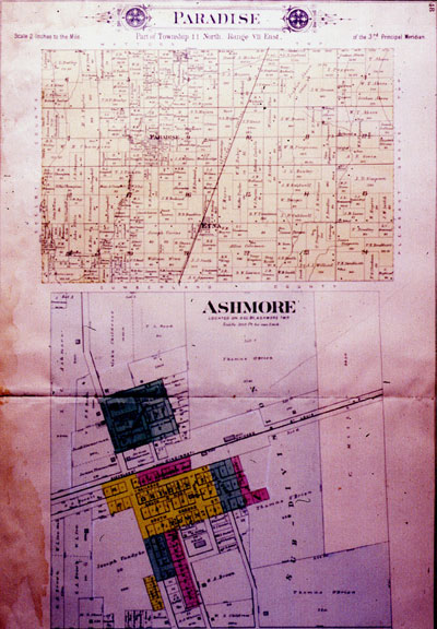
Plat of Paradise township and the town of Ashmore from the 1893
Plat Book of Coles County.

Bird's-eye and Panoramic Maps
Bird's-eye, or panoramic, maps were the nineteenth century version of aerial photographs. An artist created a drawing or watercolor of the city as seen from an oblique angle. The artist first drew the street plan in perspective, then walked down the streets sketching buildings, trees and other landscape features. These maps were typically made to promote a city, so they often showed busy streets, railroads, smoke billowing from factories, and areas planned for development. They are usually not drawn to scale.
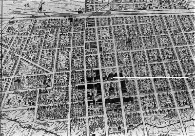
1894 Bird's Eye View of Charleston, IL.
Sanborn or Fire Insurance Maps
Fire Insurance maps were developed in the mid-nineteenth century in response to a growing need for information on the potential fire risks of individual commercial, residential, and industrial buildings. They were made until after World War II. They are often referred to as Sanborn maps because the Sanborn Map and Publishing Company of New York produced most of these maps. These maps document building materials, as well as structural features of buildings. They can be used to date building construction, alteration, or destruction.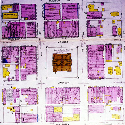
1919 Sanborn Map of the Charleston Square.


