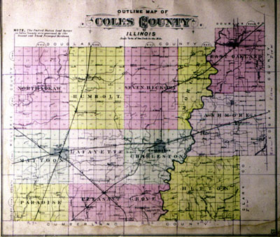
Mapping Coles County
Using Maps for Local History
Gustaaf Renier wrote, "Geography is indispensable to history because an event that is not situated in space is as difficult to incorporate in a story as one that is not situated in time. A historian should always have a map at his elbow."
Maps provide valuable information for the local historian on the political, economic, and social relationships of the community. Maps illustrate the spatial relationships between natural and man-made features. They show influential landscape elements as well as provide a record of landscapes that have long since disappeared. Maps document the growth and development or the decline of communities. They record settlement patterns, land survey methods, and land use patterns. The names that are found on maps also speak of the history of the community. The purpose of this web site is to illustrate the different types of maps that may be available to local historians, to document the map resources related to Coles County that exist in public depositories, and to provide some activities for teachers that want to use maps in teaching local history.


